
Trace Scranton Street Directory Records
An address is the safest starting point for a street-level search in Scranton. The County assessment record is designed to connect an owner, street address, or parcel ID to a property record. From there, the parcel or PIN becomes the bridge to tax, map, and deed material. A street directory is therefore a record trail, not a household roster. It may show the assessed owner and a dated association in an older source, while other people at the location may not appear in any public record.
Use each source for its actual purpose. A property search identifies the parcel. The GIS services place that parcel among nearby polygons. The Recorder supplies recorded-document references. City files can date construction or regulatory activity. Historical reverse volumes can associate an address with a printed entry in a particular year, subject to the collection actually held.
- Enter the exact house number and street in the Lackawanna Assessment Database. If that service is unavailable, use County Tax Online’s Location Address path. Save the parcel or PIN and location, not only the owner name.
- Use the County parcel and parcel-PIN services to place the address on the map. Treat surrounding polygons as land geography, then return to the assessment or tax record for non-map details.
- Take the parcel, legal reference, or owner name to the Recorder. Use Eagle Recorder for the County’s 1957-current document-search route and the Laserfiche index books for 1878-1956 material.
- Read the underlying deed or official copy when available. Work backward from a current conveyance through grantor and grantee roles, using the legal description or reference when street numbers are unclear.
- For a historical human connection, ask Albright Local History whether it holds a reverse or criss-cross volume for the target year. Then compare its printed entry with the corresponding alphabetical directory, census, newspaper, or probate material.
- Use a voter record only through the lawful individual or authorized election route. Pennsylvania does not provide a public, street-wide voter roster.
Search Scranton Addresses in Assessment
The Lackawanna Assessment Database is the principal address-to-parcel entry point. Its Basic Search exposes Parcel Number, Owner Name (Last First), Street, and Municipality, including SCRANTON CITY. Results can be sorted by Parcel, Owner, Location, or Municipality. That makes a street search useful for narrowing a location to a county parcel record, but it does not turn the database into a list of people at an address.
County Tax Online supplies a separate tax-bill interface. It distinguishes property information from owner information, which is important when a parcel’s physical location differs from the owner’s correspondence address. The documented fields below describe the public search forms, not a claim that every field is available as a filter in every mode.
| Scranton search field | Form type | Use in an address search | Verified note |
|---|---|---|---|
| Parcel Number or PIN | Text | Connects a known parcel across County property sources | Assessment Basic Search uses Parcel Number; Tax Online shows PIN. |
| Owner Name (Last First) | Text | Finds an owner entry after an address search | Tax Online says to use the name as it appears on the tax bill. |
| Street or Location Address | Text | Starts from a known Scranton location | Tax Online asks for house number and street only. |
| Municipality | Selection | Limits the Basic Search to the City | SCRANTON CITY is a documented choice. |
| Bill Type | Selection | Narrows a tax-bill search | County and Municipal/School are shown. |
| Mailing Address, City, ZIP | Owner-information fields | Compares tax correspondence with the situs | They do not establish a person’s physical presence. |
The County Tax Online lookup displays the address, PIN, bill type, owner, and mailing fields used in a tax-bill search.
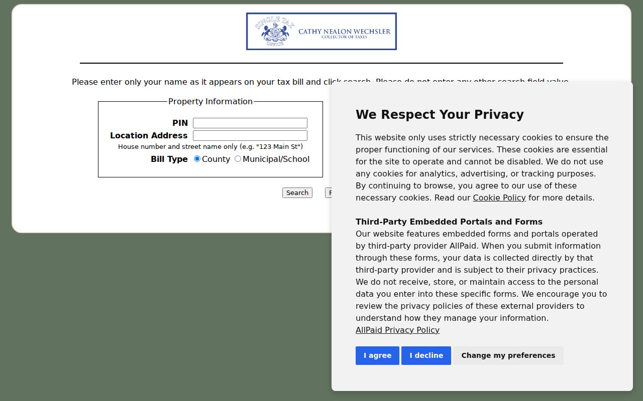
The form’s split between Location Address and owner mailing information is why a street result must be read as a tax record, not a statement about who occupies the location.
Map Scranton Street Parcels Carefully
Lackawanna County’s public GIS service directory documents Basemap, LandRecords, ParcelsAnno, Parcels, and ParcelsPINs services. The parcel layer supports a useful visual check: locate the subject parcel, see its polygon and PIN context, and then use the County’s assessment or Recorder source for the related record details. The documented services show the County’s parcel-data structure without proving that a particular consumer control is available.
Do not promise a radius search, a mailing-label export, a click-neighbors button, or another map action that has not been verified in the live viewer. Visual proximity also has limits. Alleys, vacant parcels, condominium boundaries, and multifamily structures can make adjacent land different from a social or household relationship.
The Lackawanna GIS service directory identifies the County layers used to situate a Scranton address.
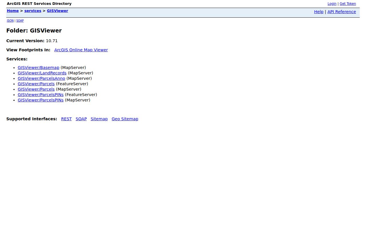
Once the map supplies a parcel or PIN, the ownership and deed questions belong back in the assessment, tax, and Recorder channels.
Follow Scranton Street Deed References
The Recorder does not organize a title chain around a modern mailing address. Move from the Scranton address to a parcel, PIN, legal description, or named party first. The County identifies two online routes: Eagle Recorder for documents labeled 1957-current and Laserfiche index books for 1878-1956. The live Eagle screen also reports a verified-document date range that begins in 1878, so the County should clarify whether that statement concerns indexing, verification, images, or another part of the service before anyone assumes uninterrupted online image coverage.
Use the title sequence in reverse: current assessed owner, acquisition deed, prior grantor as an earlier grantee, and then the preceding conveyance. Record the document category, recording reference, date, and legal description. This helps avoid a same-name match or an old street-number mismatch. The Recorder warns that its index is like a library card catalog and advises spelling variants, so an index hit is a lead to inspect, not a final title conclusion.
The Eagle Recorder self-service entry page is the County’s starting point for the modern document-search route.
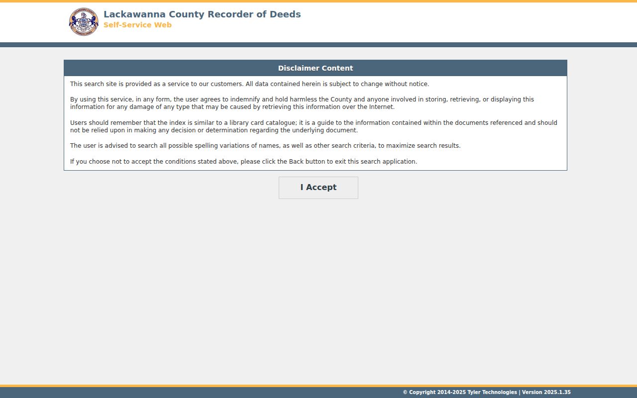
When an image or copy requires the County’s account or deposit path, the Recorder counter remains the proper route for requirements and available copies. Staff will explain fees and recording requirements, but they do not conduct a property search by phone.
Check Scranton Address Event Files
City Code Enforcement adds a building and regulatory layer to a street record. The City says construction projects require permits and describes permit, zoning, historic-preservation, floodplain, plan-review, inspection, and occupancy stages. Its public page also provides online permit-application and quality-of-life-report routes. A permit file may help date work, inspections, plans, or a certificate of occupancy where releasable. It is not a list of people who live at the address.
For a past period, make a narrow City request that identifies the exact Scranton address, date range, and the records sought, such as issued permits, inspections, certificates, or notices. The City’s Right-to-Know route is a fallback when no searchable historic interface has been verified. Keep the request tied to existing records, and expect lawful redactions or access limits.
Compare Scranton Street Directory Sources
Each address-keyed source answers a different question. Putting them in one order prevents a parcel owner, a tax mailing address, a deed party, and a printed directory entry from being treated as the same kind of fact. The street directory trail starts with the physical location and ends with a dated, source-specific record.
| Scranton address source | Custodian | What it can add | Access limit |
|---|---|---|---|
| Assessment Database | Lackawanna Assessment Office | Owner, street, parcel ID, and property-record context | The detailed service showed maintenance during research. |
| Tax Online | County tax system | PIN, location, bill type, owner, mailing city, and ZIP | Tax-bill context, not a current-resident conclusion. |
| GIS parcel services | Lackawanna County GIS | Parcel geometry, PIN labels, and visual surroundings | Exact consumer map controls were not verified. |
| Recorder index and documents | Recorder of Deeds | Recorded instruments, parties, dates, and legal references | Use the 1878-1956 and 1957-current routes as labeled by the County. |
| Code and planning files | Scranton Code Enforcement | Address-related construction or regulatory events | Request specific historic files through the City when needed. |
| Reverse directory volumes | Albright Local History and related collections | Printed address-to-name association for a particular edition | Confirm the local volume and year with staff. |
For an older printed address association, the Scranton Directory Book points to the historical collections. The County property chain should remain the main route for a current parcel question.
Define Scranton Address Records
Property systems use terms that look interchangeable but are not. Reading them correctly avoids attaching a correspondence address or an old printed listing to the wrong property question.
- Parcel or PIN
- A County property identifier that helps connect a physical location to assessment, tax, map, and recorded-document research.
- Situs address
- The physical location used for a property or tax record. It can differ from the owner’s mailing address.
- Legal description
- The recorded lot, block, subdivision, metes-and-bounds, or comparable land identifier carried in deeds and related records.
- Criss-cross directory
- A reverse printed directory arranged from an address to a listed name or organization for the edition year, if a local collection holds it.
Read Scranton Streets With Geography
Scranton neighborhood names are historical and cultural labels, not official civic boundaries. Downtown, Hill Section, South Scranton, Minooka, West Scranton, North Scranton, The Plot, Green Ridge, Pine Brook, and East Mountain can help describe local context, but they do not replace a postal, County, City, court, or school-district boundary. A street, ZIP label, census tract, and parcel municipality can point to different geographies.
For older address continuity, the Lackawanna Historical Society holds more than 1,300 maps, including Polk street-guide maps documented for 1935, 1939, and 1954. Library of Congress Scranton Sanborn volumes span several documented years. Use a map beside a deed legal description and a dated directory entry to understand a building footprint or street setting. A map cannot identify every person associated with an address.
Keep Scranton Street Directory Limits
An address search cannot reliably reveal every adult or child in a building, utility and delivery customers, protected addresses, motor-vehicle address data, or a live list of voters along a street. The public voter-status service is an individual registration channel, while voter-file access has separate statutory certification and use limits. A no-match can reflect timing, a spelling issue, a protected record, or another access rule. It does not establish that a person was never connected to Scranton.
Tax correspondence and parcel situs are also separate facts. A mailing address tells the tax office where the owner receives notices. The situs identifies the parcel’s physical location. Neither field proves who is present there. This distinction matters especially when the owner is an organization, estate, trust, or person whose correspondence goes elsewhere.
Verify Scranton Street Results
Before relying on a street result, compare the record date, the custodian, the address form, and the relationship shown. A current assessment entry may not match an older deed, a map reflects land context rather than a household, and a historical directory entry belongs only to its edition year. For a pre-1878 matter in today’s Scranton area, check Luzerne County sources as well because Lackawanna County was created from northern Luzerne County in 1878.
The strongest record trail preserves the parcel or legal bridge at every step. That practice makes a Scranton street directory search useful for property history, family research, and civic curiosity without turning a set of unrelated records into a claim about a household. Keep the source record with each conclusion.